174/260
)
)
)
)
)
)
)
)
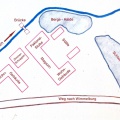
 - Lageplan der Neuen Hütte um 1800 (Quelle Infotafel am Standort).jpg")

- Veröffentlicht am
- Dé Domnaigh 11 Samhain 2018
- Abmessungen
- 2212*1560
- Datei
- Lageplan der Neuen Hütte um 1800 (Quelle Infotafel am Standort).jpg
- Dateigröße
- 463 kB
- Schlagwörter
- [134] Neue Hütte im Wimmelburger Goldgrund
- Besuche
- 1672
- Software
- Adobe Photoshop CS6 (Windows)
0 Kommentare