Fotogalerie der Kupferspuren
Willkommen!
Albums
Unser Revier
16
VMBH
422
VHM_TMP
138
BILDER
184
SONSTIGE DATEIEN
56
OBJEKTE
1492
ZEITZEUGEN (PERSONEN)
59
ARTIKEL-BILDER
479
PDF - DOKUMENTE
418
GEOKARTEN
154
TMP DIASCHAU
712
TMP BILDER IN ERLÄUTERUNGSTEXTEN (TEST)
21
3192 photos
Specials
Most visited
Recent photos
Recent albums
Random photos
Calendar
Menu
Tags
(372)
Search
Comments
(0)
About
Notification
Identification
Login
Quick connect
Username
Password
Auto login
Home
/
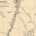
186_Geokarte Bornstedt Ackertal
3/16
Thumbnails
Previous
Next
Photo sizes
Photo sizes
✔
XXS - tiny
(240 x 160)
✔
XS - extra small
(432 x 288)
✔
S - small
(576 x 384)
✔
M - medium
(792 x 528)
✔
Original
(955 x 637)
slideshow
Show file metadata
download
Created on
Wednesday 16 January 2008
Posted on
Wednesday 16 January 2008
Dimensions
955*637
File
GeolKarte_Bornstedt_Ackertal.jpg
Filesize
272 KB
Tags
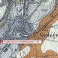
[186] Steinbrüche im Ackertal (Bornstedt)
Albums
GEOKARTEN
Visits
2737
0 comments
Powered by
Piwigo
)
)
)
)
)

0 comments