10/60
Startseite
/
GEOKARTEN
/
197_GEO Karte Text-Hohe Marl
Vorschaubilder
Zurück
Vorwärts
Bildgrößen
Bildgrößen
✔
winzig
(240 x 160)
✔
ziemlich klein
(432 x 288)
✔
klein
(576 x 384)
✔
mittel
(792 x 528)
✔
Original
(933 x 622)
Diashow
Metadaten anzeigen
Herunterladen
Veröffentlicht am
Donnerstag 29 Dezember 2016
Abmessungen
933*622
Datei
GEO_Karte_Text-Hohe_Marl.jpg
Dateigröße
433 kB
Schlagworte
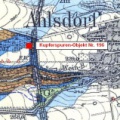
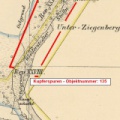
[197] Steinbruch Hohe Marl (Großleinungen)
Alben
GEOKARTEN
Besuche
2853
Kein Kommentar (0)
Powered by
Piwigo
)
)
)
)
)

Kein Kommentar (0)